eTOD Dataset Features
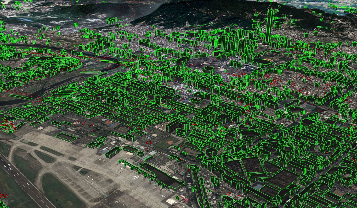
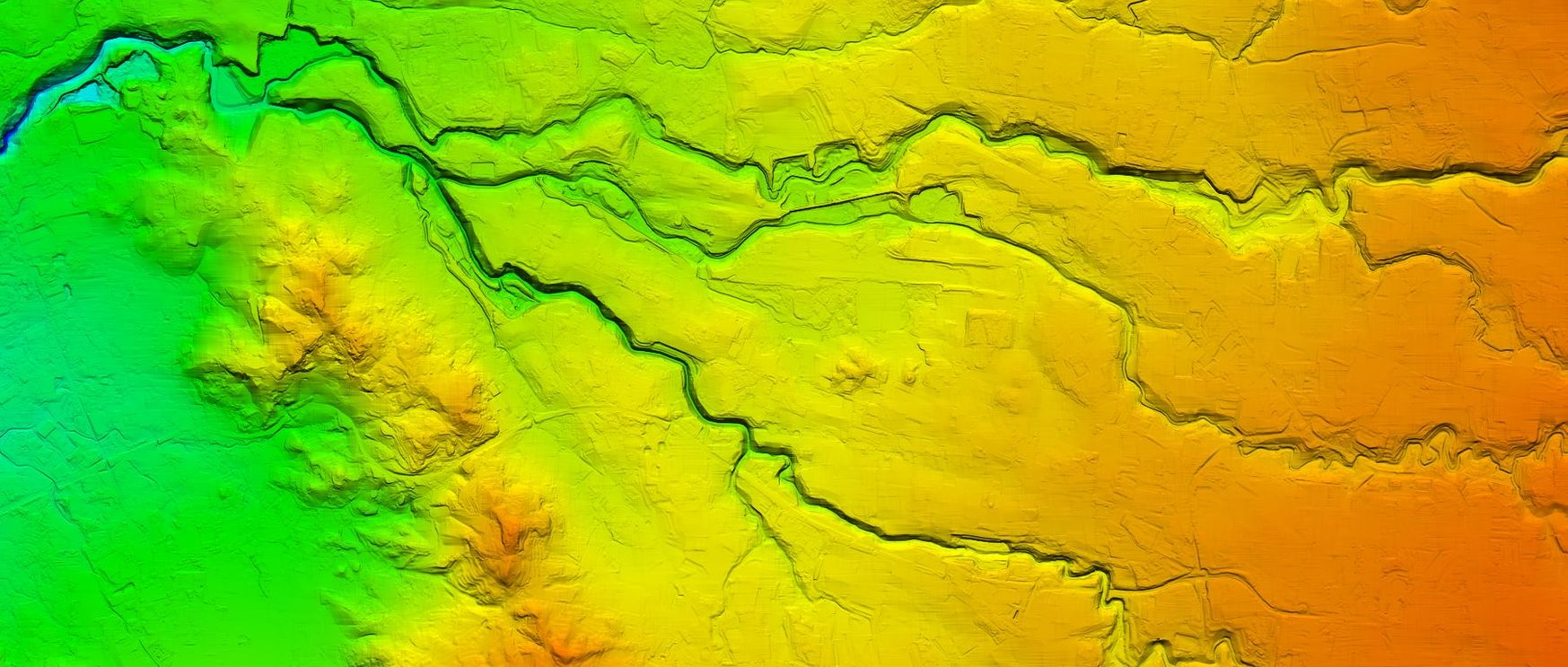
eTOD Obstacle database represents Point, Line and Polygon obstacles and their attributes identified and collected according to ICAO regulations. eTOD terrain represents bare earth, as a set of regular elevation points (elevation grid).
eTOD can be used for Electronic Flight Bags, Simulation, Flight Procedures Design, Situational Awareness. eTOD supports modern Performance-Based Navigation (PBN).
eTOD is part of the modern Aeronautical Information Management (AIM) system – which is replacing traditional Aeronautical Information System (AIS). This change is implemented in the EU as Single European Sky (SESAR) and in the US as Next Generation Air Transportation System (NEXTGEN)
Our eTOD Obstacle Data
Standards
Our company is ISO 9001 and AQAP 2110 certified. We are support the following production standards suitable for aeronautical data development:
- ICAO Annex 15, ICAO Annex 4 ICAO Type-A and ICAO Annex 14 ICAO Type-B
- RTCA DO-276/EUROCAE ED-98
- RTCA DO-291/EUROCAE ED-119
- Compilancy with Eurocontrol ADQ (Aeronautical Data Quality)
Formats
We support different formats suitable for geospatial databases including AIXM:
- AIXM (Aeronautical Information Exchange Model)
- ESRI Geodatabase/ ESRI Shapefile
- KML/KMZ (Google Earth format suitable for data visualization)
Technology
Collection of imagery from a satellite or fixed wing aircraft do not disturb the operation of the airport. The use of high resolution imagery allows for the collection of all required man-made or natural obstacles such as:
- Buildings, Trees, Power Lines
- Very narrow (but danger objects!): antennas (also those mounted on rooftops), poles, or protruding branches of trees
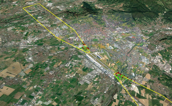
eTOD ICAO Areas
We support eTOD obstacle data production for all ICAO Annex 15 areas:
- Area 1: the entire territory of a State
- Area 2: terminal control area (or 45 km from ARP)
- Area 3: aerodrome/heliport area
- Area 4: Category II or III operations area
Our eTOD Terrain Data
Standards
Our company is ISO 9001 and AQAP 2110 certified. We support the following production standards suitable for aeronautical data development:
- ICAO Annex 15, ICAO Annex 4 ICAO Type-A and ICAO Annex 14 ICAO Type-B
- RTCA DO-276/EUROCAE ED-98
- RTCA DO-291/EUROCAE ED-119
- Compilancy with Eurocontrol ADQ (Aeronautical Data Quality)
Formats
eTOD Digital Elevation Model should be represented in a regular elevations grid format. We support these formats:
- GeoTiff
- DTED
- ASCII
Technology
We build terrain models using satellite or aerial imagery, starting from automatic correlation of elevation points. Next all areas are manually checked and edited to maintain accuracy requirements. Our eTOD Terrain:
- Is produced using best accuracy standards suitable for aeronautical data
- Undergoes independent quality tests
- Represent bare earth, without vertical objects as buildings or vegetation
eTOD ICAO Areas
We support eTOD terrain data production for all ICAO Annex 15 areas:
- Area 1: the entire territory of a State
- Area 2: terminal control area (or 45 km from ARP)
- Area 3: aerodrome/heliport area
- Area 4: Category II or III operations area
We are offering also ICAO Precision Terrain Chart product based on eTOD Digital Elevation Model.
eTOD Area 1 Data Collection
Innovative technology for eTOD Area 1 obstacle data collection
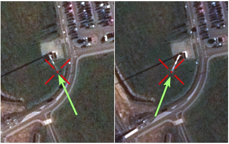
Collection of obstacle data within eTOD Area 1 can be very demanding and technologically challenging. All objects above 100 meters are required to be collected within the entire territory of a State. Often times these obstacles (radio mast or antenna on top of building) are difficult to capture because of their narrow width.
To address these challenges, KPGeo developed a unique technology that uses mono satellite imagery for obstacle data acquisition. We created an algorithm to automatically calculate obstacle heights based on measurements from the mono satellite imagery.

High coverage of mono satellite imagery used as the source

Approximately 7-10 times lower price than other sources (LiDAR/stereo imagery) used to capture obstacles

Ability to recognize and collect of even very narrow objects

The accuracy of obstacles height acquisition meet the standards for ICAO Area 1 requirements requirements
ICAO Type A and Type B Map (Electronic)
ICAO Annex 4 specification indicate, Type A and Type B Obstacle Charts are no longer required, when eTOD Annex 15 is available. However, to meet our customer’s expectations, we are offering electronic versions of Type A and Type B Obstacle Charts based on eTOD. Electronic versions of Type A and B Obstacle Charts include obstacle databases, generated using analysis related with Obstacle Limitation Surfaces (OLS – ICAO Annex 14), and Take Off Flight Path Area (TOFPA – ICAO Annex 4).
1
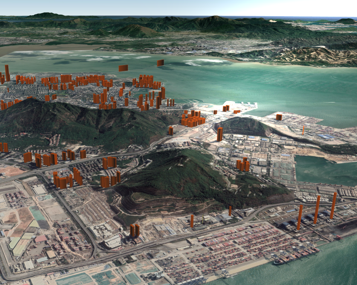
ICAO Annex 15 Obstacle Database (eTOD)
eTOD Obstacle Database done according to numerical requirements of ICAO Annex 15 fo Area 2 (Terminal Control Area).
2
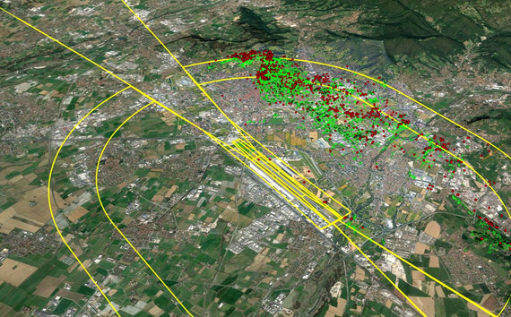
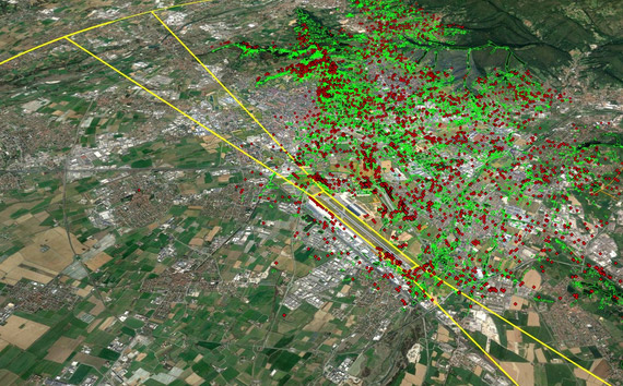
ICAO Annex 14 Obstacle Database (Type B - Electronic)
ICAO Annex 14 Obstacles Databases
3