AMDB Features
An AMDB database is organized into more than 40 layers. Those layers represent the following categories:
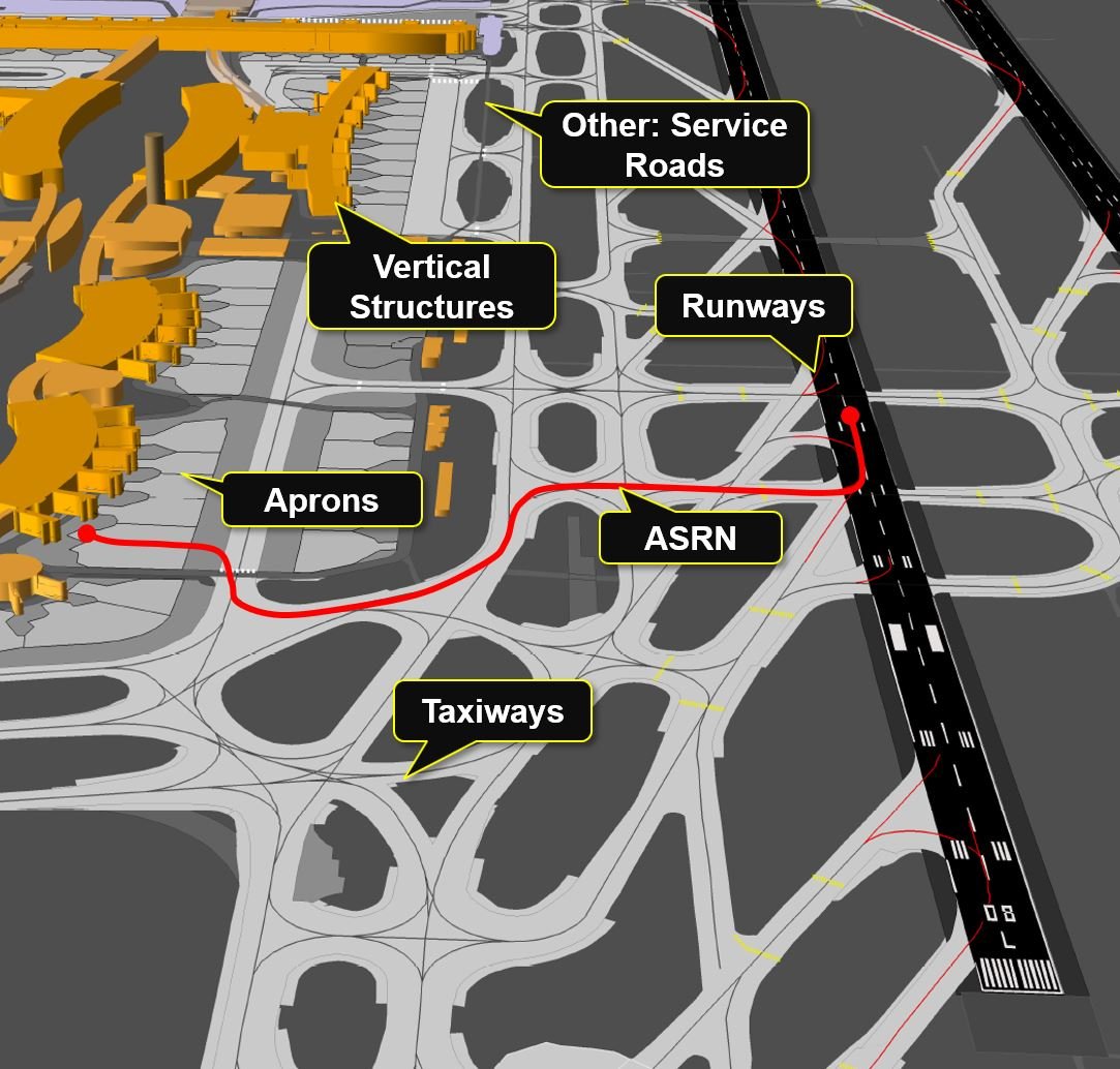

Runways
Runways, Runway Shoulders Thresholds, Runways Markings, Stopways

Taxiways
Taxiway Guidance Lines, Taxiway Shoulders, Taxiway Markings, Holdings

Aprons
Aprons, Parking Stand Areas, Stand Guidance Lines

Vertical Structures
Terminals, Hangars, Trees, Poles. Towers

Other
Service Roads, Aerodrome Signs, Water

ASRN
Aerodrome Surface Routing Network
Our AMDBs
Industry Standards
We support the following production standards suitable for aeronautical data development:
- Annex 15 to the Convention on International Civil Aviation (ICAO Annex15)
- RTCA DO272/EUROCAE ED99
- RTCA DO291/EUROCAE ED119
Accuracy
We create AMDBs in two accuracy standards:
- AMDB Fine: below 1 meter of horizontal and below 0.5 meter of vertical accuracy (confidence level: 95%)
- AMDB Medium: below 5 meters of horizontal and below 3 meters of vertical accuracy (confidence level: 90%)
- Coordinate system: Horizontal – Geographic WGS84, Vertical – EGM96
Formats:
AMDB output formats are suitable for GIS databases.
- AIXM 5.1.1 (Aeronautical Information Exchange Model) – format developed by Eurocontrol and FAA to enable management and distribution of AIM (Aeronautical Information Management) data in digital format
- ARINC-816-3 (Embedded Interchange Format for Airport Mapping Database)
- ESRI Geodatabase/ ESRI Shapefile – well known GIS formats
- KML/KMZ (Google Earth format suitable for data visualization)
Technology
An AMDB is derived using georeferenced imagery (satellite, aerial or drone).
- Imagery are adjusted to the ground situation using highly accurate Ground Control Points
- Digitisation of aerodrome objects using georeferenced imagery provides up-to date and accurate AMDBs
- All required attribute information are derived based on official AIP documentation
- Our AMDBs represent 3D geometry of aerodrome objects